Nuku Hiva
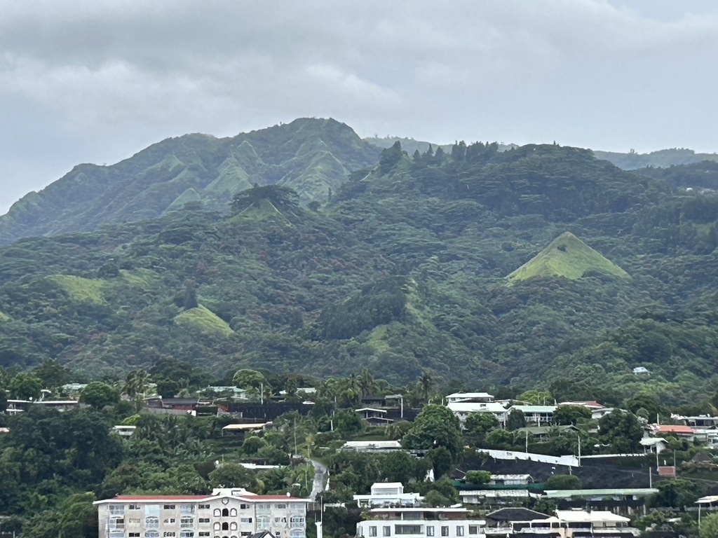
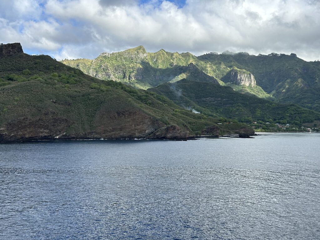
Our first port is Nuku Hiva one of the 14 islands that make up the Marquesas group. It is the capital of this group, the biggest of the Marquesas Islands, and the second biggest island in French Polynesia after Tahiti. Its rugged wooded terrain rises to Mount Tekao which is 3,888 ft. It contains many Polynesian stone house foundations, fortifications, and temples.
Archaeological evidence suggests that the Marquesas Islands may have been settled about 200 BCE from western Polynesia. It wasn’t until the 1500s CE that the Europeans arrived. France annexed the Marquesas in 1842 and built a fort on the island. Prior to its annexation by France, the islands were controlled by the British, Spanish, Americans, and French at various times from the 1500s on.
Herman Melville visited the Island in the 1940s and Nuku Hiva is the setting for his first novel, Typee, and its sequel Omoo. He described the island as a “country that no description could fit the beauty.” Robert Louis Stevenson’s first landfall on Nuku Hiva was during his voyage on the Casco in 1888. He later made Nuku Hiva is home and died here.
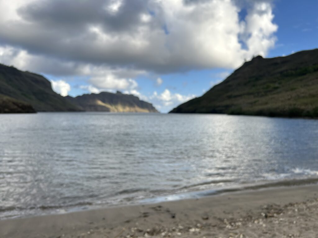
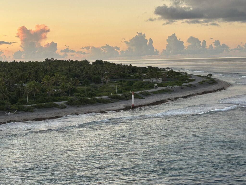
The coastline of Western Nuku Hiva is characterized by steep cliffs with small bays leading to deep valleys. The eastern part of the island is nearly inaccessible because of the ocean swells. The north is indented by deep bays with villages. The south has fewer bays, but the dramatic Vaipo Waterfall is there. It is the highest waterfall in French Polynesia with a drop of 1,148 ft.
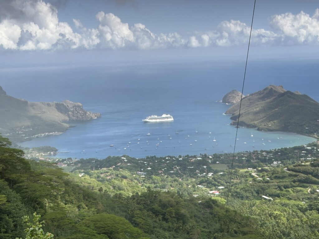
Our ship is anchored on the south side of the island in the town of Taiohae.
On my tour, we drove across the island to the North Side town of Hatitue and then went to the end of the road at the beautiful beach in Anaho, visiting three of the five villages on the island.
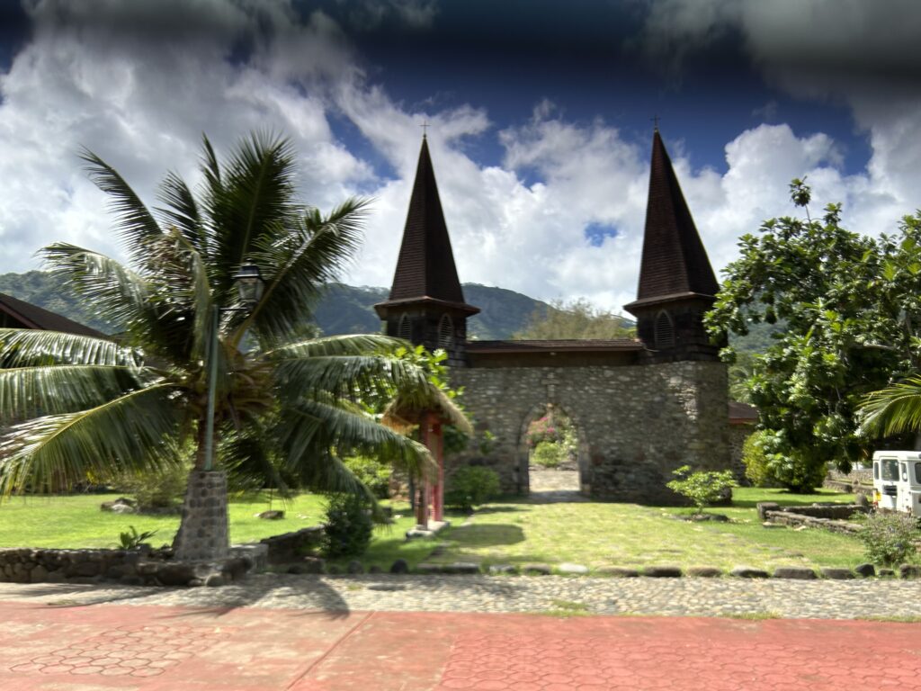
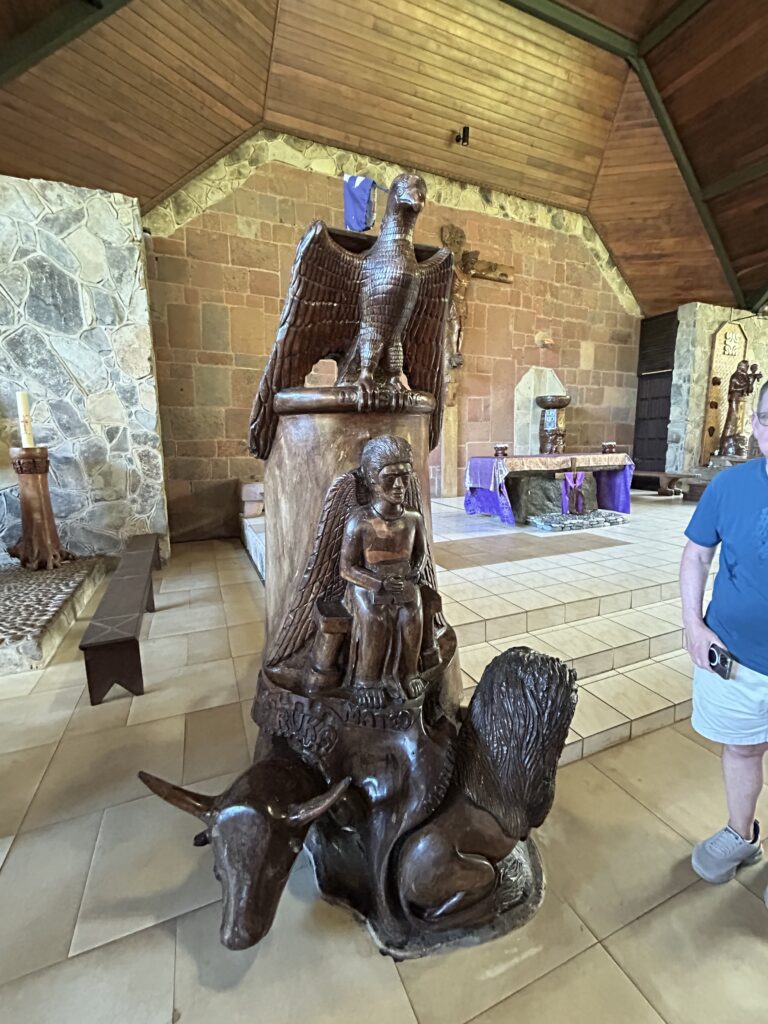
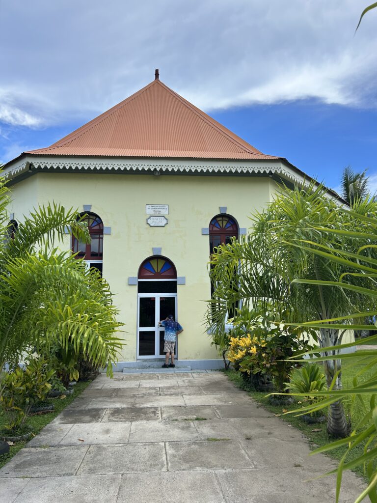
Our first stop in Taiohae was the Roman Catholic Cathedral. It has a wonderful history and has incorporated indigenous art and wooden sculptures throughout. The stones used in its construction were sourced from the various islands in the archipelago, making it a unique blend of local materials. Many came from the original Aboriginal holy site. Built in 1977 the cathedral replaced an older church that burned. The elaborate pulpit and crucifix together with the stations of the cross are all carved in local wood by local artists. Also, the archway in front of the church is restored from its former site.
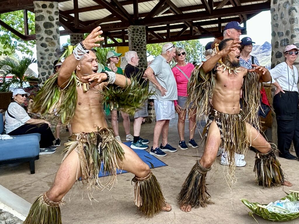
Our next stop, Tohua Koueva, is notable for its extensive communal structures and is believed to have belonged to the war chief Pakoko, who was killed in 1845. This site offers a unique look into the Marquesan way of life, showcasing their social and cultural practices. Archaeologists have unearthed many important artifacts here including a large ceremonial stone platforms known as papae, ancient tiki statues, and petroglyphs depicting humans and animals. These findings provide valuable insights into the daily lives and spiritual beliefs of the Marquesan people
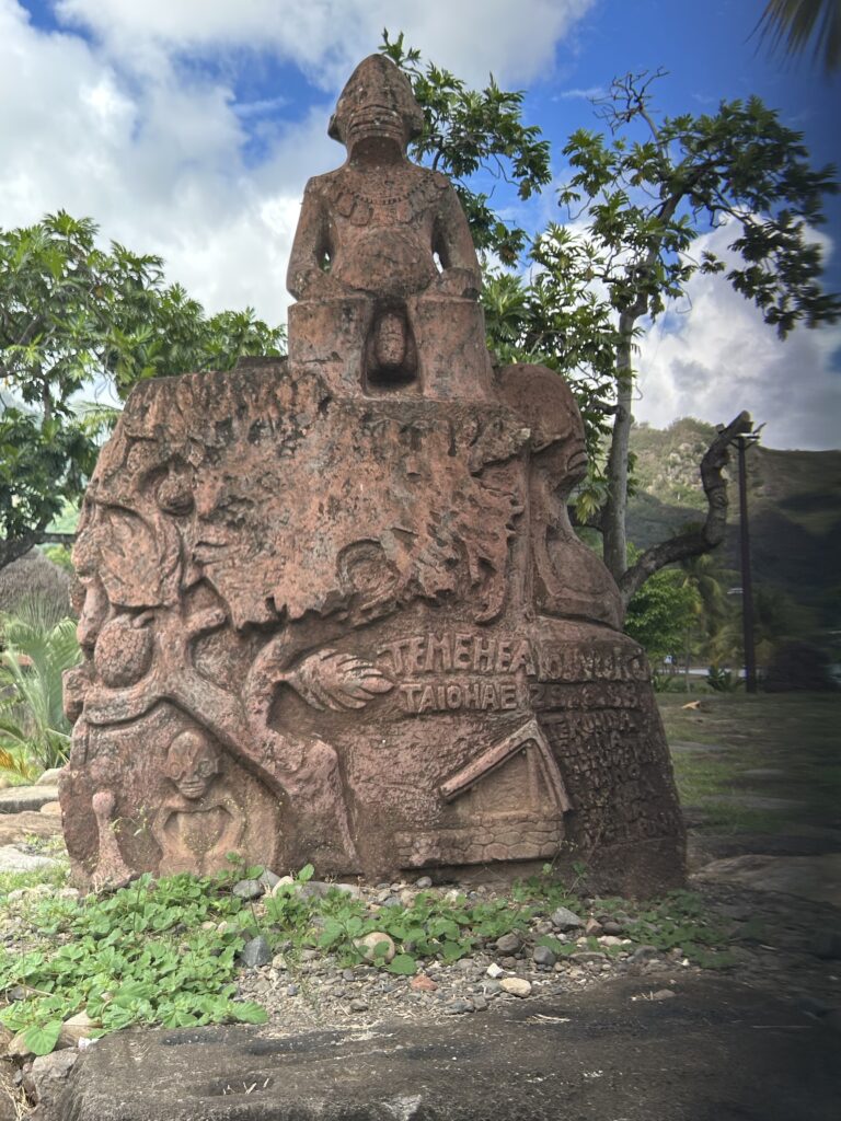
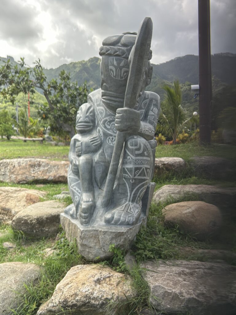
Our next stop was Temehea Tonua along the seafront. Here we saw stone monuments carved by artists from different islands in French Polynesia. Archaeologists determined that they dated back to between the 11th and 14th centuries, and are likely depictions of ancient Nuku Hivan deities.
Hikokua is one of the most powerful archaeological sites in the Marquesas. Discovered by archaeologist Robert Suggs in 1957, it dates to around 1,250 CE and was used until the 1800s. The site features a vast, central, rectangular platform that was used for dance performances during community festivals. Flanked by tiers of small flat basalt blocks, these steps were once used by spectators.
Along the way we stopped at several viewpoints that showcased the islands beauty.
Our next day is a sea day enroute to the island of Rangiroa, a large atoll about 350 km northeast of Tahiti in the Taumotu Archipelago. Our lecture was on Thor Heiadal’s Kon Tiki expedition.
Rangiroa
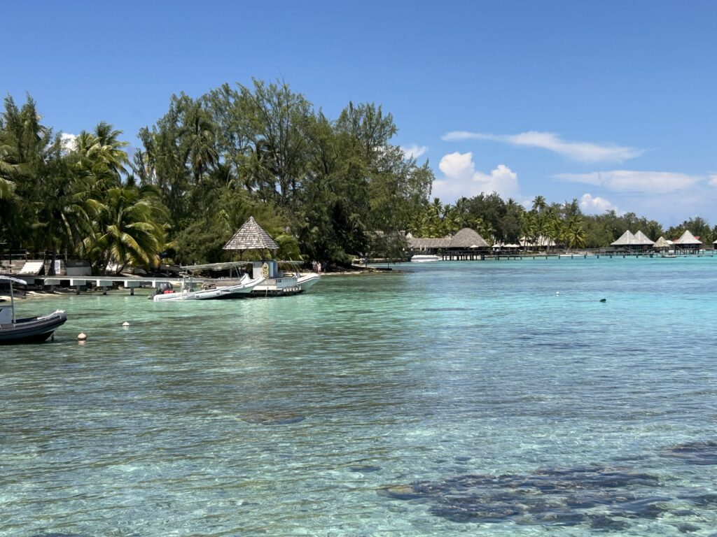
Today we anchored off Rangiroa, a string of coral encircling a turquoise and jade-green lagoon. The old Polynesian name for the atoll is Rairoa meaning “huge sky”. Rangiroa is in the Tuamotu Archipelago and is the biggest atoll of French Polynesia and second largest in the world. It has two main villages: Avatoru and Tiputa. The rest of the atoll is covered with coconut plantations.
The two villages are surrounded by two legendary bodies of water, Moana-tea (Peaceful Ocean) and Moana-uri (Wild Ocean). The atoll is a natural aquarium and an abundant spot for Scuba divers with numerous fish, rays, barracudas, and sharks. It is also a breeding ground for natural black pearls.
In addition to coconut and pearls, Rangiroa is also known for its vineyards and wineries.
I tendered into the atoll and wandered for about, enjoying the serenity and beauty. As we were getting ready for dinner, we saw a group of dolphins swim by our balcony.
Mo’orea
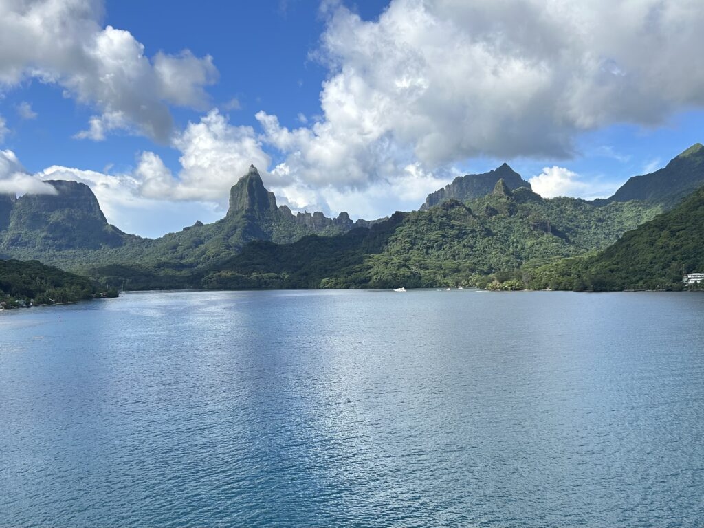
Today is a big day. We anchored off Mo’orea, called the Magical Island where we stayed most of the day. Mo’orea is believed to be the Mythical Bali Hai from Michener’s Tales of the South Pacific. Mo’orea means “yellow lizard” in Tahitian. An older indigenous name is ‘Aimeho. The island is located only 10 miles from Tahiti in the Society Islands of French Polynesia.
According to archaeological evidence, Mo’orea and the Society Islands were colonized from Samoa and Tonga about 200 CE. The first Europeans settled here in the 18th century CE, first the British then the French.
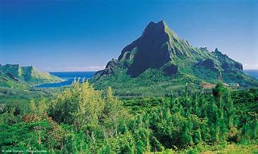
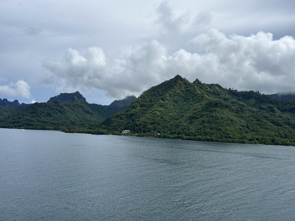
Mo’orea is striking in its scenery. It has two large bays, Cook (Paopao) and Opunohu, separated by Mount Rotui. A heart shaped island, it is known for its dramatic volcanic peaks and turquoise lagoons with coral gardens, rays, reef sharks, and tropical fish. There are eight mountain peaks on the atoll.
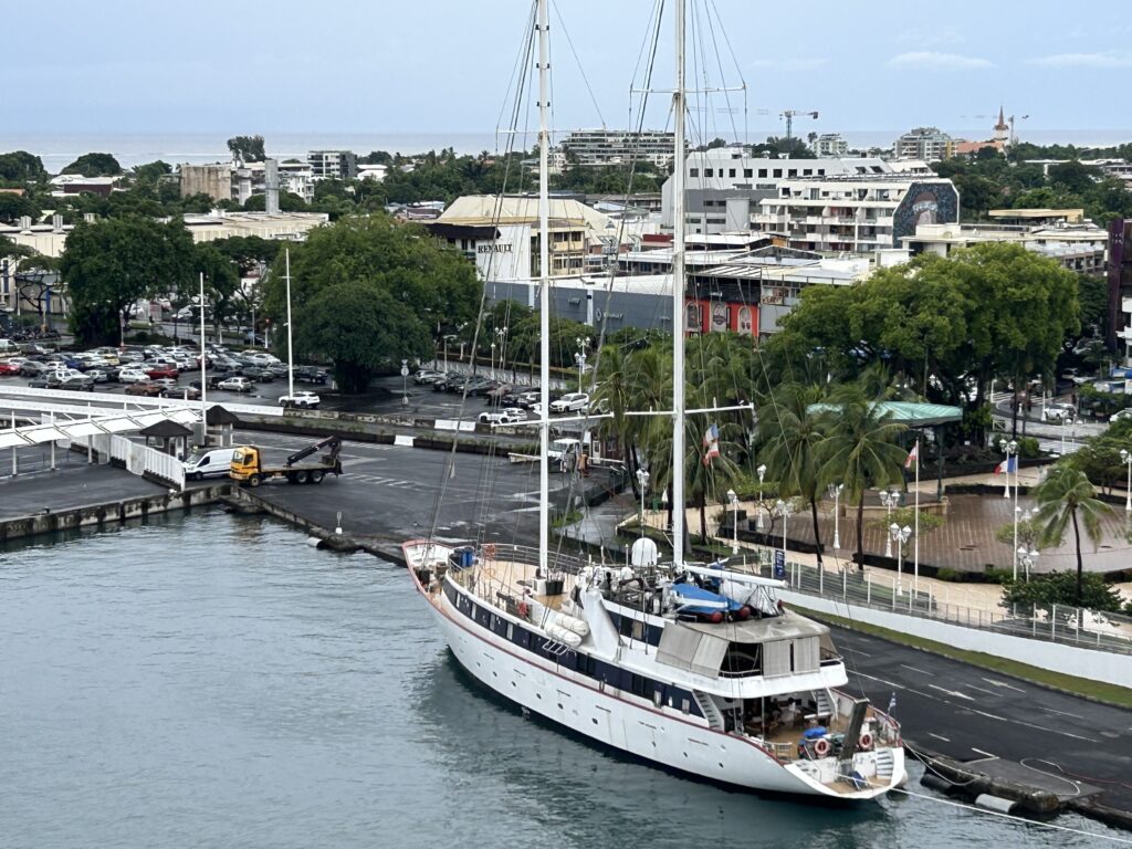
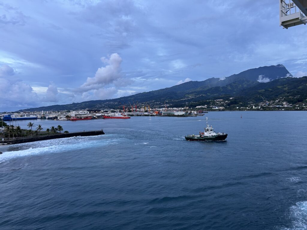
Then before dinner, we sailed the 10 miles to Tahiti and docked in Pape’ete.
Tahiti
Tahiti is the largest of the Windward Islands in the Society Islands. The island of Tahiti consists of two ancient eroded volcanic cones, Tahiti Nui and Tahiti Iti, connected by the narrow Isthmus of Taravao. Pape’ete lies on the northwestern coast and is the capital of French Polynesia and its most populous island.
Tahiti was first settled by western Polynesians between 900 and 1100 CE. The migration started in Southeast Asia to Fiji, Samoa, and Tonga. The first Europeans came from Spain and Portugal in the late 16th Century. It was annexed by France in 1880. French is the official language; however, Reo Tahiti (the native language) is widely spoken.
The terrain is mostly high and mountainous with beaches and coral reefs surrounding the island. The interior is almost totally uninhabited. There is one main road that circles the island. Mount Orohena rises to 7,339 ft. on Tahiti Nui and Mt. Roniu to 4,340 ft. on Tahiti Iti. The island is fringed by coral reefs and lagoons.
French painter Paul Gauguin, who lived on Tahiti and then Hiva Oa, was inspired by the local culture. He painted Polynesian images and spiritual themes in the works he created here.
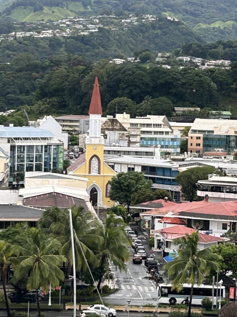

Pape’ete
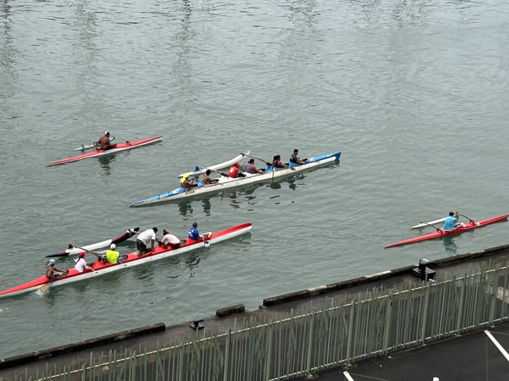
Today is pouring. I am glad we had no excursions. Pape’ete is like a big port city, looking from the ship. Looking up into the mountains showed the beauty it is famous for. In several ports we rowers came out to greet us or see us off. Several people left the ship here, but 400 new travelers boarded.